Information |
Island Colour Map |
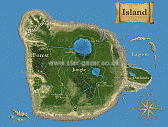 |
Other maps available here.
|
|
Location |
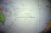 |
The precise location of the Island.
|
|
Bow Drill |
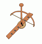 |
A typical bow drill used for making fire.
Image courtesy of Wikipedia Commons.
|
|
Jack's Bow Drill |
| The bow drill Jack made was not as refined as the one shown above, but the principle was the same.
Hard and soft wood are rubbed together to make heat. Pressure is applied from above, and the spindle rapidly turned using the bow, which simply wraps around the shaft.
Tinder is set to the base to catch a spark, and this is nurtured to flame. Time to carefully begin crafting a fire.
|
|
Lord Howe Island |
| The images right show this relatively nearby island. Many of these photographs represent what The Outlands may look like, at least in places.
Lord Howe Island is the remains of a volcano rim; the Outlands is composed of one complete caldera, with remnants surrounding.
These images are shown to stir the imagination.
|
|
Volcano Walls |
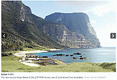
| The image of Mount Gower opposite, shows the type of volcanic walls that trapped Jack on the Outlands.
Imagine these many times higher, and Jack an unsure climber with a fear of heights.
|
|
Lagoon |
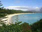
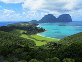
| Lord Howe Island lagoon shows a smaller version of what lay by the Village on the Shore. It was Jack's larder, and the below depicts the vista Jack looked out upon.
|

|
The lagoon of The Island was much larger in size.
|
|
Palm Fruit |
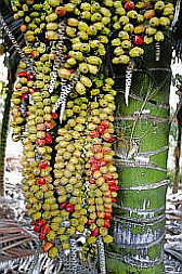
| In Book One the twins climb a palm tree and bring down a large frond of fruit.
|
|
The type is not specified, but Jack thinks they may be date palm fruits. The image above is of Lord Howe Island Kentish Palm fruit, which are similar in appearance to what was found on the imaginary Outland interior.
|
|
Banyan Tree |
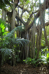
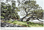
| Banyan trees are quite common in Canton, where the author lives.
Because of their root and aerial root systems, they are capable of growing in some surprising places.
|
|
The banyan tree mentioned on the books is similar to this, except the top of the tree is still in place.
Over time, the Banyan tree matures and becomes top-heavy. Often the upper part breaks off. However, in similar ways to a Yew, the tree continues to grow, forming a circle of new trees growing out of the old.
|
|
Nearby Islands |
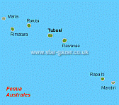
| The nearest islands to the imaginary Island of the book are mainly atolls, although some are larger and support trading populations.
"Nearby," means hundreds of nautical miles.
|
|
Many of the above islands were researched regards flora, fauna, and means of life. The information received was used as background knowledge.
The descriptive passage immediately left, is typical of the author's known world, and slightly colder than 'The Island'.
Note: the mention of coffee, salmon, and oysters.
|
|
Gorge |
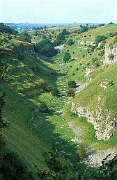
| During Jack's first day on the island he is faced with crossing a gorge, and thinks better of it.
The defile would not be dissimilar to the one pictured below, except the one Jack faced was very much steeper and impossible for him to climb that day.
|
|
During the Trials of Passage, pōscerea must cross a narrow divide that is too far to jump. Most climb down one side, and up the next.
Given the above image, were the sides much closer, the narrow gorge would look very similar to that show.
|
|
Lord Howe Island Tourism |
| Below is the latest official Lord Howe Island Tourism brochure, free and clean to download as a pdf.
It is an interesting read, and not overly long. Please click the image below to open it.
|
|
Further Information
|
|
Lord Howe Island |
Below are some more images of Lord Howe Island, just to complete the picture.
|
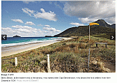 |
Binky Beach
|
Note the wind sock, indicating the beginning, or end if taking off presumably, of the island runway. This appears to be a fairly level grass field.
|
|
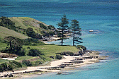 |
Lovers Beach
|
|
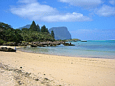 |
South Beach looking North
|
|
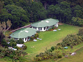 |
Milky Way Villas
|
|
|
General Information |
Background Facts: Island Structure and Design
|
| |
Island Information |
|
|
|
| Information about the Island:
flora and fauna, caldera type, similar islands, Lord Howe Island
Before the trilogy was begun in earnest, several important points had to be decided; an author must know what he is writing about. Major concerns are listed below:
- Island location
- Latitude and hemisphere
- Isolated or near other habitable regions
- Type of island
- Atoll, surrounding a peak like Nevis, or with a large caldera like Tahiti.
- Type of sand = black or golden?
- This has impact on what natural resources are likely to be available, especially agate for use as blades.
- Resolving issues of flora and fauna took many weeks of dedicated research, and these needed to be found on relatively nearby islands.
- Coconuts? Only found on tropical islands. The author decided these had been wildly overused in castaway novels, and would not be available. That in turn meant the island itself was not in tropical latitudes.
- Arctic and cold climes were also discounted as being restrictive, and also regards health, and sustaining the castaway, Jack.
- The author lives a few hundred miles inside the Tropic of Cancer, but Canton (Guangdong) is considered to be sub-tropical. Coconuts do not grow there naturally. Much of what the author saw in daily life, would grow
easily on the imaginary island, and he would be able to write from known fact, not research.
- The outcome was the island would be sub-tropical, but where?
- Location. After examining alternatives, the obvious position was an isolated region of the South Pacific, just south of the Tropic of Capricorn, and midway between New Zealand and Chile.
- It needed to be 'no where' people ever ventured; well off commercial and vocational routes for ships and aeroplanes.
- After much research, a suitable location was discovered.
- Type of island.
- Tahiti was perfect, but a little too small, and in the wrong place. Everything else was exactly what the author was looking for. This became the basis for an imaginary island due south.
- Flora and Fauna.
- This lead to the largest body of research, including nearby islands, and those farther afield. The perfect template would be based on Lord Howe Island, that research alone running into weeks.
- Nasties: flies, mosquitoes, snakes, rats, scorpions, whatever. Did the Island have 'nasties.? No! Neither to any degree, does Lord Howe Island.
- The remaining research was to determine what did live and grow on the Island. Long lists of good and banned ensued, until the author had a basis from which to pick and choose at will.
During preparations for writing, the author assembled a vast body of notes and references, which have been severely pruned, and are offered below.
Location
The island is located in the central area of the South Pacific at about longitude 150 West, latitude 25 South.
There is a submerged volcano at position -25.085599, -148.345642 that proved suitable. The size was about right were it were poking above water. It featured several smaller crowns as well as a large central caldera, which was perfect.
The reason for non detection by contemporary science, explorers, and satellites was simple, it was hidden by an Ancestral shield. Meaning, what is on current maps, is all we can detect.
Geometry
The Island caldera began as being roughly circular, about thirty-miles in diameter. Due to distances the Islanders could walk or, run to and return in one day. The boundaries became extended in places, to the northwest especially
(Badlands). At the extremes {viewed as a grid measurement), the Island is forty-five miles wide by thirty-five in diameter.
As with Tahiti, outside of the main caldera lies a headland, called The Outlands. This is where Jack arrived, at the southern point nearest the volcano walls. The Outlands are approximately five-miles in diameter, again stretched
slightly in places.
Both the main Caldera, and outlying islands, are the pockmarked by later volcanic issuance, leaving behind the remnants of many earlier eruptions. Regards the main Island, these provide topographical features. Outside, there are
the remains of many volcanic peaks that once broke the surface. Now little remains; a rocky spire, small and larger islands to the west. Others lie scattered around, mainly providing an underwater hazard to shipping.
The Outlands are curious, in respect the area is composed of the remnants of separate caldera's. There is a small, almost barren one to the south, largely engulfed by the hostile seas; the prevailing forces of wind and ocean
current are particularly strong to the exposed South. What remains is partially shielded by the main caldera. This is where Jack was washed ashore.
The main body of The Outlands is an almost preserved caldera, whose only breach lies to the east, where it forms natural golden beaches east and north. Otherwise it is a secluded area.
A third caldera of much older origin abuts these to the north. The area is comparatively sheltered, and is where Jack creates the Village. Built upon the remnants of caldera walls, the village looks out across a submerged
caldera towards a broken ring of rocky outcrops, the remains of the greater caldera walls. Between lies a lagoon, which provides ample food from the sea.
Geology
The island is composed of basalt lava flows, which means the sand is yellow. These outpourings build up in thin layers over time, and also feature runs and rifts; most suitable for the imaginary Island. This also defined the volcano,
as the type known as Shield Volcano.
Shield Volcanoes
Shield volcanoes are made from basalt lava flows that build over a long time. They can be very large, such as the ones that form the Hawaiian Islands chain.
http://en.wikipedia.org/wiki/Shield_volcano
This in turn means that quartz is present, as are many other items, and permits the making of some form of glass if required. Pumice is also present, although the presence of flint is highly unlikely.
The only problem is that shield volcanoes tend to have shallow sides and many weather badly. However the remaining heights of Lord Howe Island would tend to disagree with this statement, and confirm the hypothetical island could
be a reality with supporting technical facts.
Sand
Research extracts and references:
“Sands rich in magnetite are dark to black in colour, as are sands derived from volcanic basalt's and obsidian.” http://en.wikipedia.org/wiki/Sand
Note: This is explained more precisely in José's <blockquote> below
[Reference: The Wrath of Gaia Explained.doc].
"Andesitic magma is an intermediate form of magma, and when found outside of the Andes chain, is usually caused by a mixing of Basaltic and Rhyolitic magma, at a continental Plate boundary in this instance. Temperatures
are roughly 800 to 1, 000 degrees Centigrade, and contain fewer silicates than the previous type. This is often grey in colour, as with the Canary Islands off northwest Africa; or say, Tahiti. This in turn means that in our vacation
world, the associated beaches will have black sand."
Black sand should have a low silica content, and so is unsuitable for making glass. It can be worked in other ways beyond normal technology
Volcanic sand – Black Sand:
Special type of heavy mineral sand is volcanic beach sand. It is usually black in colour and may contain minerals like olivine, augite, and hornblende, which are major rock forming minerals but usually rare in sand because of weak
resistance to weathering. This sand type is especially common in volcanic islands because rocks that these islands are made of (mostly) basalt, contains usually no quartz. Some volcanic sands may be reddish because mafic (basalt
and similar) volcanic rocks contain lots of iron, which gives reddish appearance to weathered rocks and sand grains.
This sand type is beach sand. It does not include pyroclastic material like scoria, pumice or tuff found inland. Volcanic sand may be composed of minerals, fragments of volcanic rocks or both.
Examples: The Andes, Canary Islands, Tahiti (places).
White / Yellow Sand:
Shield volcanoes (Due to their enormous size and longevity); often give rise to white or yellow sand on their beaches. This is because they have been around long enough to be subject to limestone deposits and subsequent degeneration,
which is associated also with the presence of quartz.
Examples (Volcanic Islands only): Hawaii, Polynesia, Micronesia.
Leading volcanologist, Clive Oppenheimer, has warned of a one-in-500 chance of the earth being hit by a “super- volcano” this century.
Evidence shows large earthquakes (category eight or thereabouts) can trigger volcanoes up to 1, 000km away, and that the recent devastating earthquake off Japan’s coast could trigger another volcano in the vicinity.
References: Volcanoes
Volcanic
· http://www.volcano.si.edu/world/find_regions.cfm
· http://en.wikipedia.org/wiki/Pacific_Ring_of_Fire
· http://en.wikipedia.org/wiki/File:Plates_tect2_en.svg
· https://www.aapg.org/explorer/2005/01jan/ghawar.cfm
· http://upload.wikimedia.org/wikipedia/commons/b/b4/Plate_tectonics_map.gif
· http://en.wikipedia.org/wiki/Lists_of_volcanoes
|
Once the location, size, and make-up of The Island had been decided, research moved on to defining what it would be like to visit. |
| |
Comparative Islands
There are several real islands relatively close to this imaginary one:
Mataura (North: -23.368732, -149.480667).
Raivavae (Northwest: -23.861978, -147.650757).
Rapa Iti (Southwest: -27.605671, -144.327393) lies in the Bass Islands of French Polynesia. It is often referred to as Ahurei [Ahurei in the Austral Isles] and (West Southwest: -27.608105, -144.342499)]; by mistake;
this being the main town where most of the 500 population live.
Below is a descriptive passage by Anon
Rapa's temperate climate is not warm enough for corals to grow, nor coconut trees, where the Australs' winter temperature in July and August can go down as low as 5°C.Yet how many fruits vegetables, either familiar or unknown
elsewhere, grow on her fertile soils? Sweet oranges, pears, figs, passion fruit. Coffee bushes which produce an excellent coffee, but also a huge variety of taro, succulent root crops and with "mungu" which are plants
with pinkish flowers and sugary tastes that children love to suck for candy.
Goats and wild cattle live in the mountains. They augment the daily menu of the islanders alternating with salmon, crayfish, seas slugs, oyster, and sea urchins that are in great abundance near the shore.
The shellfish will be native, but the livestock not. Most of the fruit and vegetables are probably of imported or commercial origin = not naturally native.
Marotiri (Southwest: -27.868217, -143.525391).
Tahiti
One of the major design concerns was that the fantasy island had to make sense if it existed in real life; Tahiti was all but perfect.
Jack's landfall would be a place similar to Toahatu, south where beaches appear on Google satellite view (-17.778848, -149.309778).Wikipedia supplies demographics which seem to indicate Tahiti naturally supports around 10, 000
indigenous people. Tahiti is a trading nation, the Islanders are not. Allowing for the far warmer climate, and dietary restriction imposed by a self-contained island; I consider the maximum population of The Island over millennia
to be about the same (10, 000).
Wikipedia (general info): http://en.wikipedia.org/wiki/Tahiti
Interestingly; the CIA World Factbook (https://www.cia.gov/library/publications/the-world-factbook/geos/fp.html) is of very
little assistance in this instance.
Genealogy
Regards the Islanders, who were always destined to be a surviving enclave of homo sapien erectus, Polynesians caused the largest research problems. The excellent, though flawed webpage:
http://www.travelersjournal.com/press2.php?ID=3200
is interesting. It relates that southern isles (Rapa) exhibit certain traces of Hakka lineage dating back 3, 000 years (1Kbc).
"They had remarkable knowledge of the stars, winds, and ocean currents”. Their ancestral lineage is that of Lapita culture, an Ancient Pacific Ocean Archaeological culture.
Domesticates consisted of pigs, dogs and chickens. Horticulture was based on root crops and tree crops, most importantly taro and yam, coconuts, bananas and varieties of breadfruit. This was supplemented by fishing and mollusc
gathering. Long-distance trade of obsidian, adzes and favourable adze source rock and shells was practiced."
http://en.wikipedia.org/wiki/Lapita refers. Also see ‘Origins’ and bottom of the page.
Relationship to Above?
Whilst Homo Erectus and Neanderthals are nowhere in the same timeline or post-deluge group, there is a slight similarity with Hakka being related to Formosa, and common hereabouts in eastern Asia. However, the premise remains they
followed previous peoples many tens of millennia later.
Note: It is accepted by the scientific community that the waves of Polynesian settlers into Melanesian territory (= they were already there), was due to pressure from others forcing them to flee, or move-on.
Recent studies are in conflict, as it appears the inhabitants of Easter Island came from South America – meaning they came back searching for their long-lost heritage. (References: an article in the Daily Telegraph online circa
July 2011).
From varied research and due consideration of humanities, the author considers that Homo Erectus did the same around 30, 000 BC = circa original Aboriginal Walkabout.
Maba Man from Shaoguan in northern Guangdong Province, is dated to 122, 000 years ago, and there is debate as to whether this was Homo Erectus as originally labelled, or early Homo Sapien – due to differing internal cranium and
skull depth. The remains most likely represent a crossbreed, which is a sub-plot underlying the trilogy.
Flora and Fauna
The Island flora and fauna is based upon that found on Lord Howe Island.This island lies at a slightly lower latitude, but in more sheltered waters between Australia and New Zealand.
A large, separate file was created from research, containing full descriptions of all forms of extant life, plus many pictures and links. http://www.telegraph.co.uk/travel/destinations/australiaandpacific/australia/8325719/Lord-Howe-Island-Australia-an-island-entire-of-itself.html
proved to be a great resource, and led to this link:
http://www.lordhoweisland.info/
which in turn led to this supporting reference
http://en.wikipedia.org/wiki/Lord_Howe_Island
This research defined The Island as being composed of basalt lava flows, which meant the sand is yellow. This also defined the volcano caldera as being a Shield Volcano – one of the largest craters in the world is in Hawaii, where
one of these island types is fifty miles (97km wide).
However, there will be special species regardless. See above and below.
Many of the plants and animals are also based upon those found in the Kermadec Islands northeast of New Zealand. They are on latitude around 30 degrees south, and lie directly west of The Island. Natural currents would bring many
living things directly to The Island. http://en.wikipedia.org/wiki/Kermadec_Islands?1294894868
Some of the ones included:
When all the research was done, the author wrote about what he knew about: 'Wu Tao', one form of Chinese potato.
Without reproducing seemingly endless lists, there remained one point to address: sewage. Reed beds and certain tuberous plants do the job admirably, hence: Reed bed sewage treatment as defined by http://www.johnstonsmith.co.uk/fact17.html
|
By this point, The Island was defined. Jack had been washed ashore, and made his home in The Village. His tools and constructions were crude at first, improving over time. The original story described
his life on the shore in great detail, did not 'move along' much, until he transported inside the volcano walls. Many chapters of this, the author's first try at writing, were either deleted or extensively abridged; 'The
Missing Chapters' represent the abridged remnants, and describe this period in greater detail. "Author, Edit thyself!"
The next big thing was about to occur, meeting the Islanders. They were already defined as homo sapien erectus, and had lost the use of virtually all tools; their existence was primitive Stone Age, but with highly advanced
science. The two did not fit together.
|
Tools
The Second lost the ability to use many tools during the harsh climate circa 10, 000 BC, which they call The Dark Time. From a population of 12, 000 people they were reduced to just a few hundred, before building back to their
contemporary number of around 7, 000.
They still retained highly advanced skills of working stones and rock, knives, and sharp-tipped wooden spears. The legacy of an old irrigation system remained to water crops, but they had forgotten how best to use it. They build
round houses, using fir and bamboo frames covered in grass panels. Their clothes were made from grass also, and they retained high skills in working and platting different grasses for strength, purpose, and decoration.
Body decoration was simple and normally consisted of flowers, and grass linked chains to which were attached stones and other pretty things. For festivals they used natural body paint making weird designs on their bodies, and dying
their black hair with henna. Their only clothes were grass skirts for women, usually with a small tunic top, and grass shorts for the men – although all of these could be quite elaborate.
They mainly use stone carved beakers and plates, eating with their fingers. Basket weaving was highly advanced, and had many everyday uses. However, apart from the main props for housing, wood was not used very much, perhaps another
skill they lost over time.
Regards sewerage treatment they do use reed beds, which are quite complex and work very well.
It is perhaps easier to list the skills they have lost, which include: fire, proper irrigation, flour milling, boats, bow and arrow, and the wheel. Jack returns these skills to them, but copies them from their own design as left
in one of the ancient caves.
This website is a rich resource for showing how to make ancient tools
http://paleoplanet69529.yuku.com/
|
|
|
Lord Howe Island |
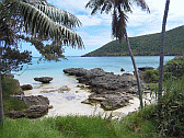
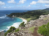
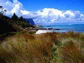
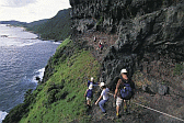
| The images below were inspiration for the physical aspects of The Island.
They are reproduced here courtesy of Lord Howe Island Tourist Board, and/or the Australian Government.
Please refer to their website for the originals.
|
|
Lord Howe Island |
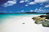 |
Idyllic beaches
|
|
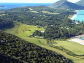 |
Milky Way Vista
|
|
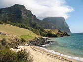 |
Twin Peaks
|
|
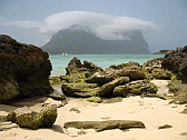 |
Heads in the clouds
|
|
 |
Lagoon beach
|
|
 |
Mount Gower
|
|
 |
Walk or cycle
|
|
 |
Island Museum
|
|
 |
Lord Howe Earl
|
|
 |
Small Headland
|
|
 |
Lovely Colours
|
|
 |
Care for a stroll?
|
|
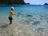 |
Feeding the fish
|
|
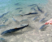 |
Big Fish
|
|
 |
Bigger Kingfish
|
|
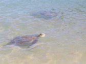 |
Turtles too
|
|
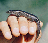 |
Gecko
|
|
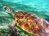 |
Another Turtle
|
|
 |
Double Headed Iag
|
|
 |
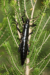
Stick Insect
|
|
 |
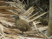
Black Stick Insect
|
|
 |
Ground Bird
|
|
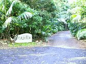 |
Arajilla
|
|
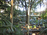 |
Banyan Trees
|
|
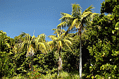 |
Howea Forsteriana
|
|
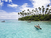 |
Fishing in the lagoon
|
|
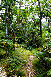 |
Island Forest
|
|
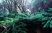 |
Forest Ferns
|
|
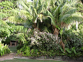 |
Palm Ferns
|
|
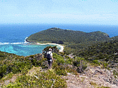 |
Looking South
|
|
 |
This is Heaven
|
|
|